FREE UK Shipping on orders over £75 | Every purchase supports the British Library


£25.00
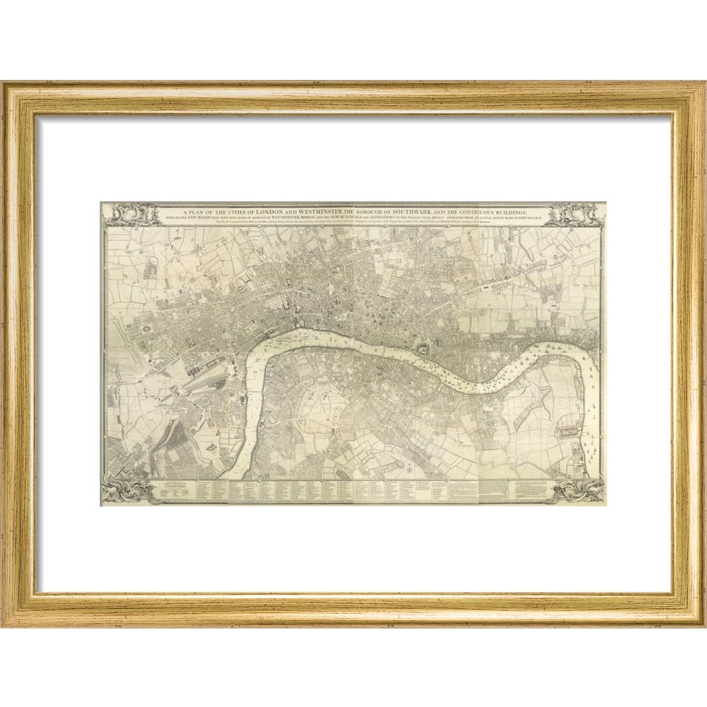
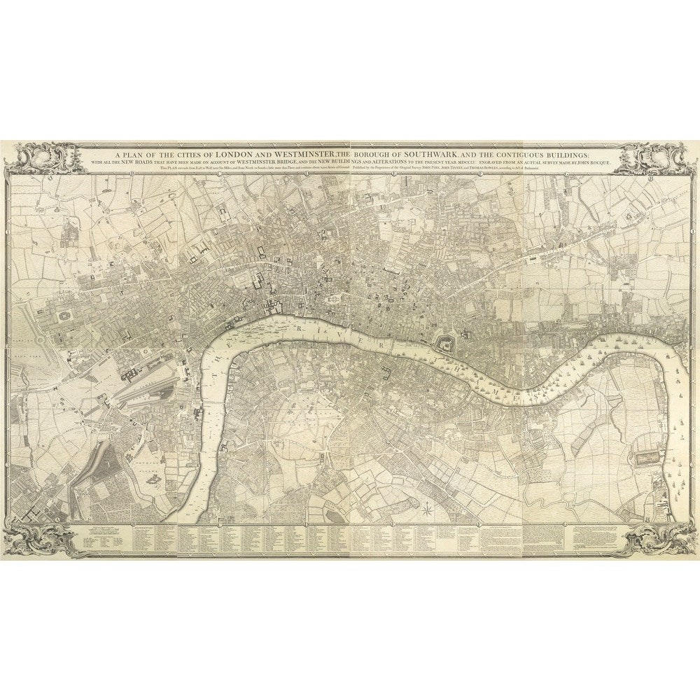
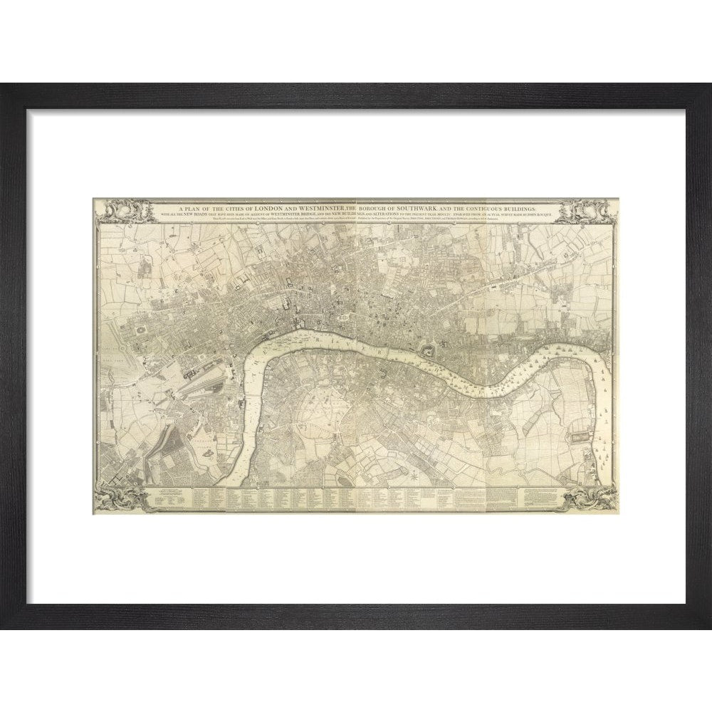
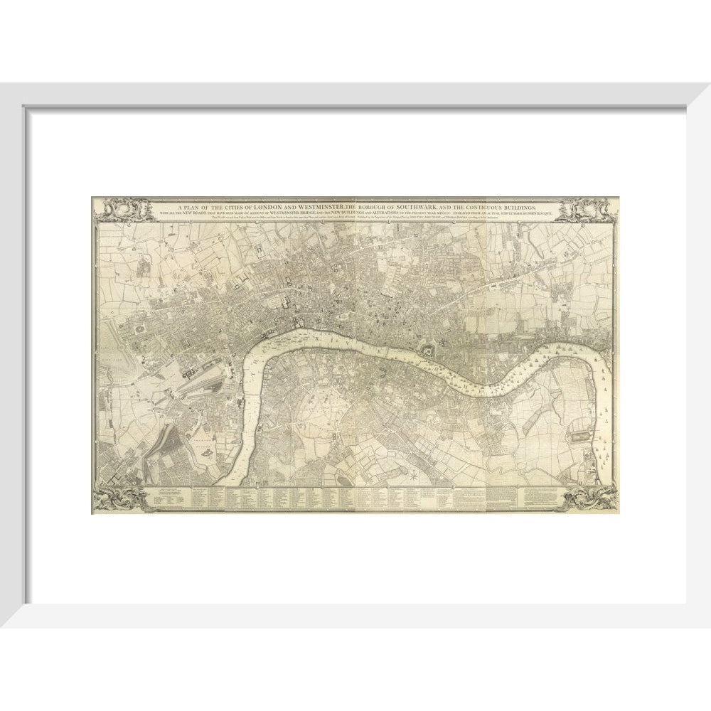
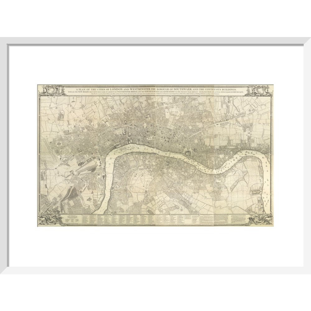
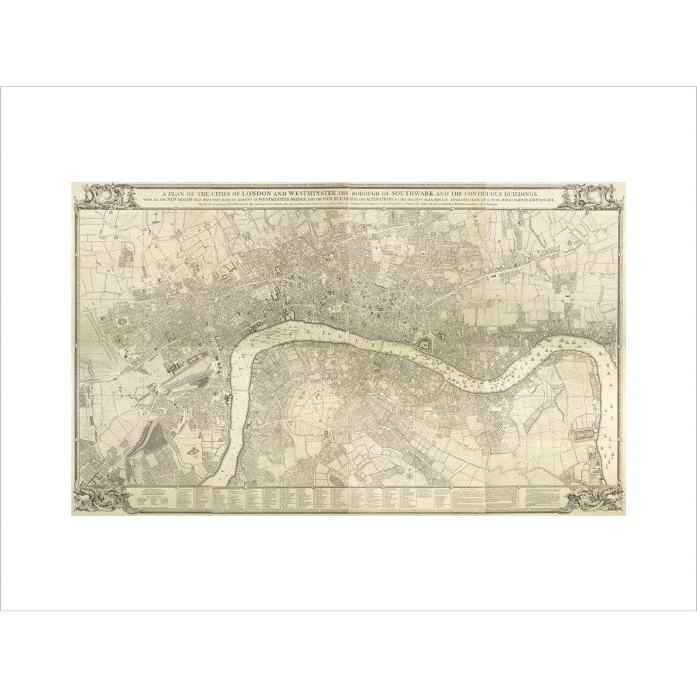
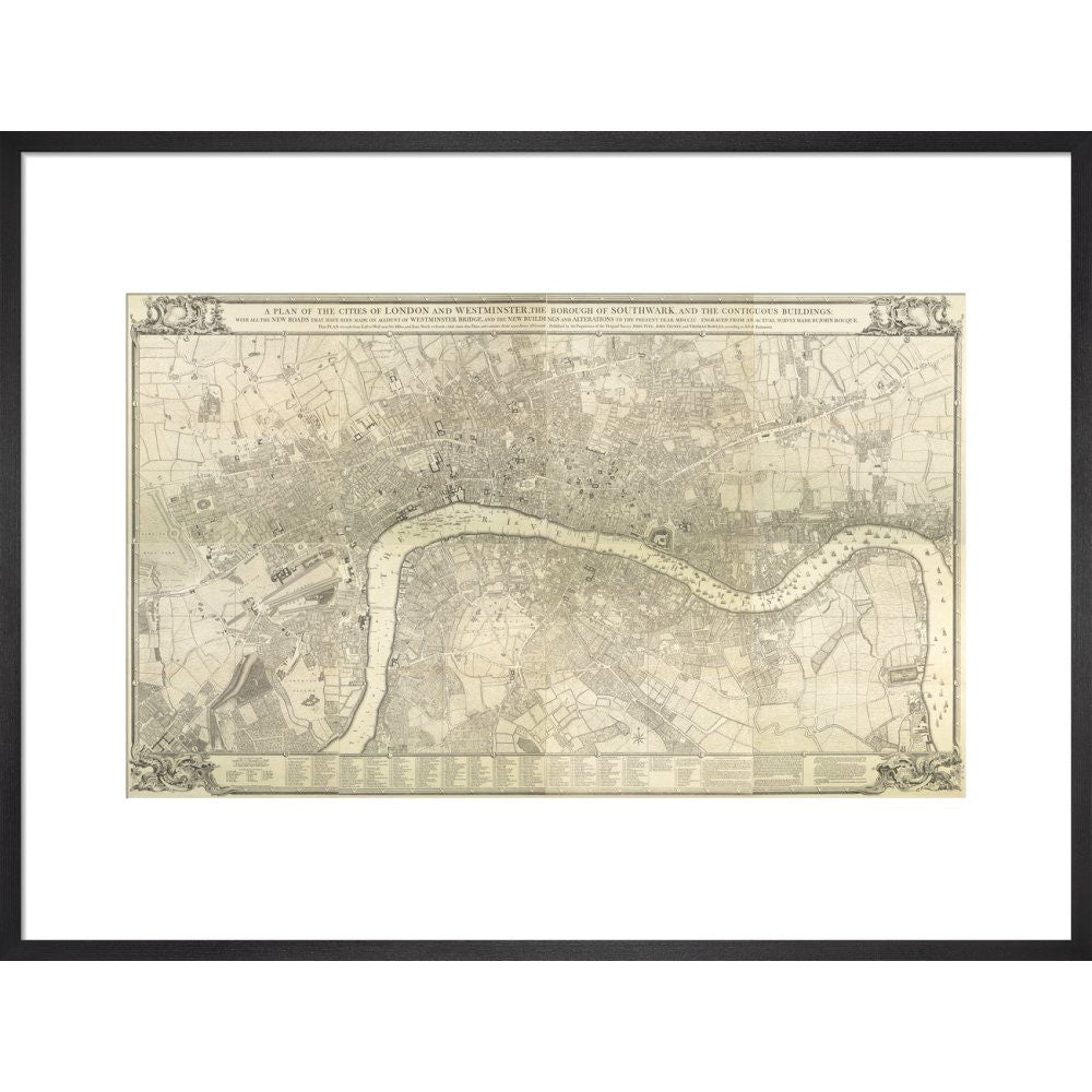
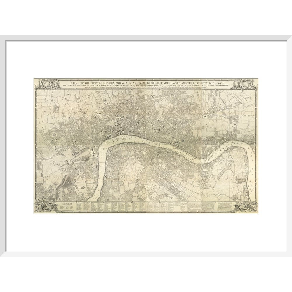
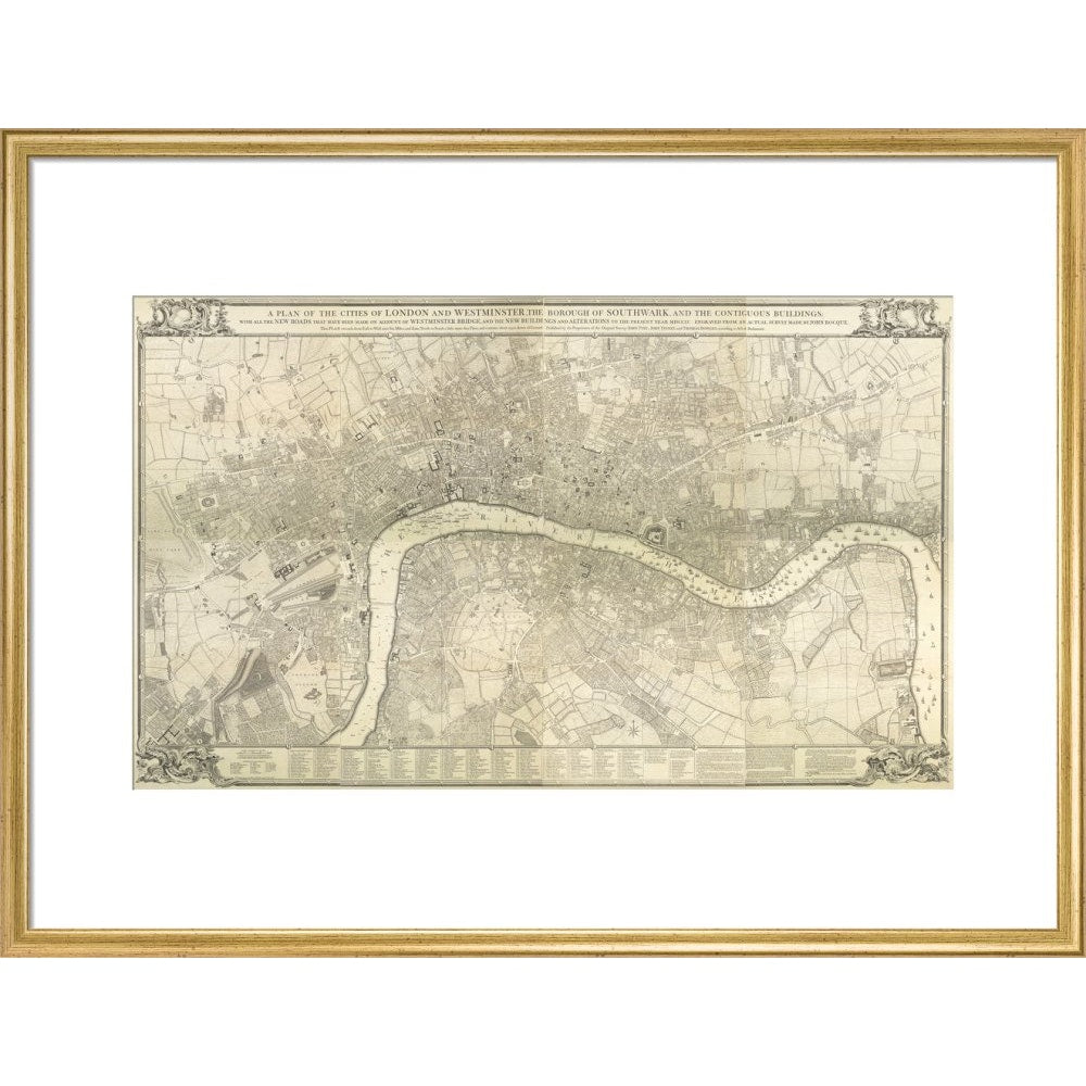
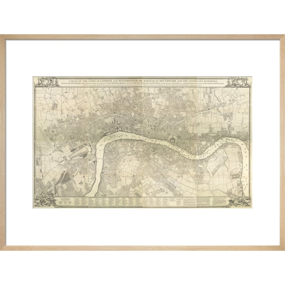
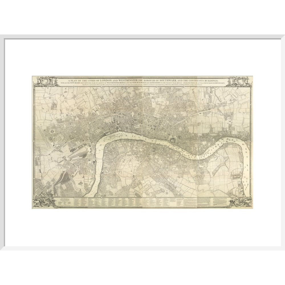
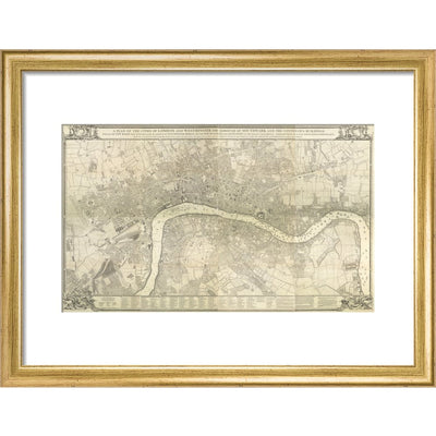
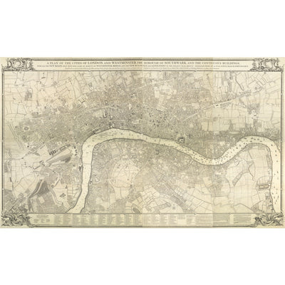
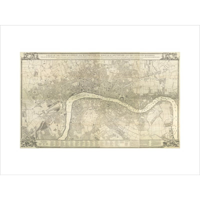
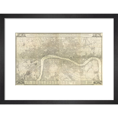
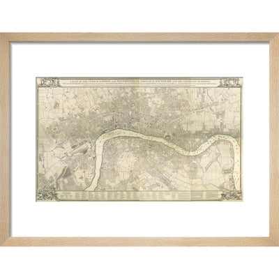
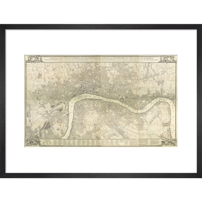
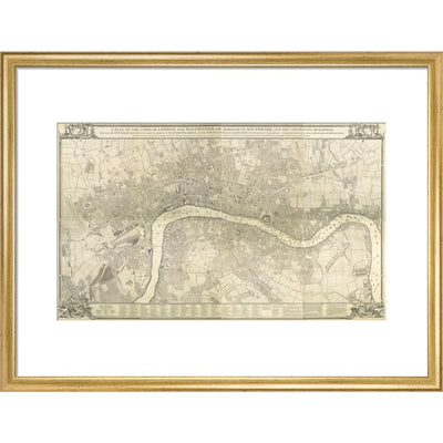
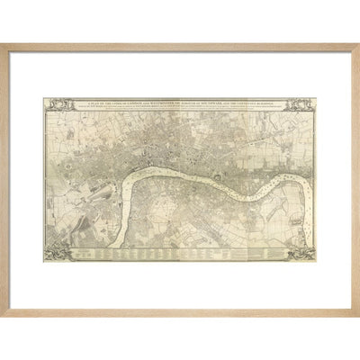
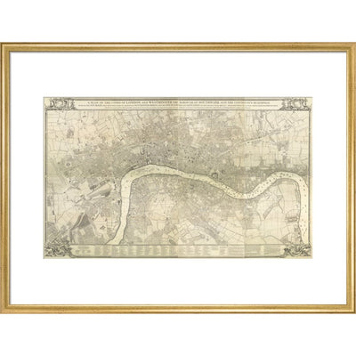
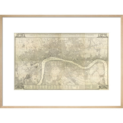
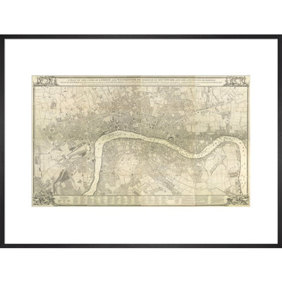
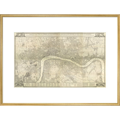
A historic map of 18th century London created by John Rocque. The text reads: A plan of the cities of London and Westminster, the borough of Southwark, and the contiguous buildings: with all the new roads that have been ,ade on account of Westminster Bridge, and the new buildings and alterations to the present year MDCCLV. Engraved from an actual survey made by John Rocque. This plan extends from East to West near six miles, and from North to South a little more than three, and contacins abiut 11500 acres of ground. Locations marked on the key include Aldgate, St George's Hospital, Skinners Alms-House, Mile End, the Exchequer, House of Commons, Court of Request, House of Lords, Mary le Bone Church, Westminster Infirmery.
Creator: John Rocque